
Price: $73.95
(as of Oct 06, 2025 20:27:40 UTC – Details)

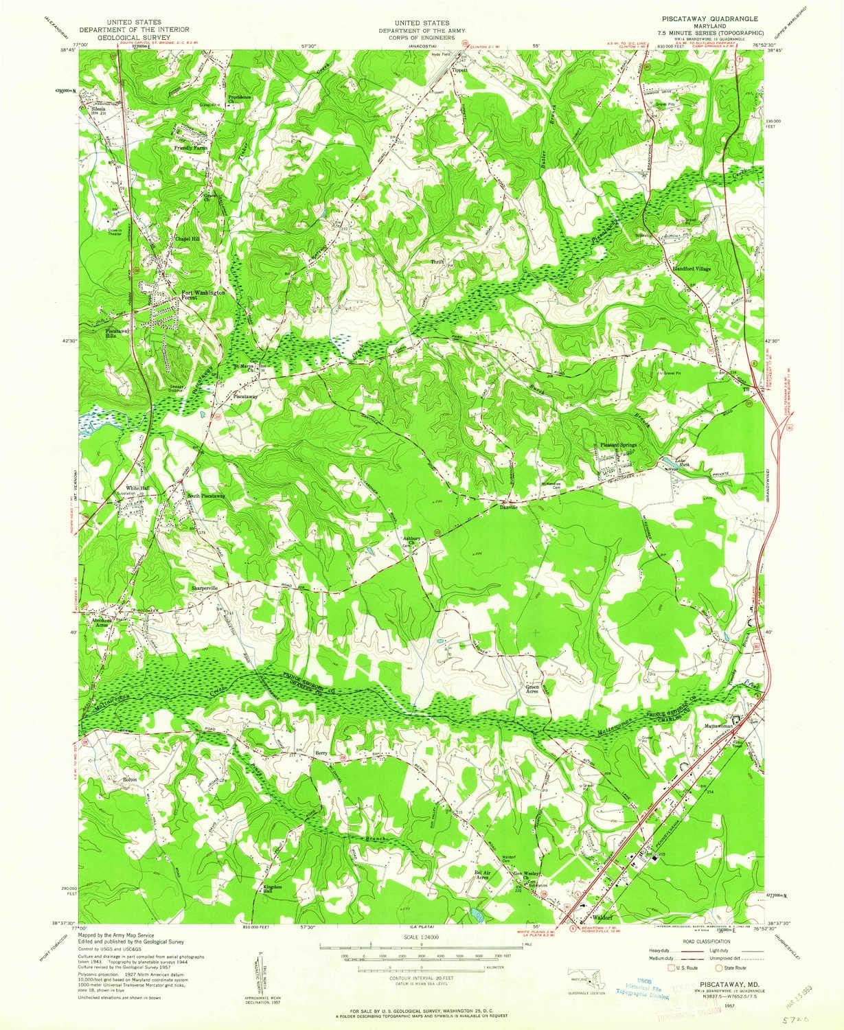
USGS topographic map of Piscataway, Maryland, dated 1957, updated 1963.
Includes geographic coordinates (latitude and longitude), lines of elevation, bodies of water, roads, and more. This topo quad is suitable for recreational, outdoor uses, office applications, or wall map framing.
Printed on-demand by YellowMaps on the print material of your choice.
Shipping rolled from Minneapolis, MN, United States.
Product Number: USGS-5366978
Map Size: 26.8 inches high x 22 inches wide
Map Scale: 1:24000
Map Type: POD USGS Topographic Map
Map Series: HTMC
Map Version: Historical
Cell ID: 35439
Scan ID: 256710
Imprint Year: 1963
Woodland Tint: Yes
Aerial Photo Year: 1943
Survey Year: 1944
Datum: NAD27
Map Projection: Polyconic
Map published by United States Army Corps of Engineers
Map Language: English
Scanner Resolution: 600 dpi
Map Cell Name: Piscataway
Grid size: 7.5 X 7.5 Minute
Date on map: 1957
Geographical region: Maryland, United States
Northern map edge Latitude: 38.75°
Southern map edge Latitude: 38.625°
Western map edge Longitude: -77°
Eastern map edge Longitude: -76.875°
Surrounding map sheets (copy & paste the Product No. in the search bar):
North: USGS-5389822,USGS-5367596,USGS-5367598,USGS-5389824,USGS-5368576
East: USGS-5367624,USGS-5365840,USGS-5365842,USGS-5365846,USGS-5365844
South: USGS-5366596,USGS-5366592,USGS-5366588,USGS-5366590,USGS-5367732
West: USGS-5366794,USGS-5299816,USGS-5366796,USGS-5930487,USGS-5366788
Printed on Polypropylene (plastic)
USGS topographic map of Piscataway, MD, at 1:24000 scale. Heavier material. Waterproof. Tear-resistant. Foldable. Perfect for the outdoors.
Cities, towns, villages: Acton Village,Treeview Estates,Clinton Hills,White Oak Village,Pleasant Springs,Old Ford Hills,Old Fort Acres,Holly Tree Park,Tantallon South,Belleair Estates,White Hall Forest,Piscataway,Clinton Acres,Accokeek Acres,Fox Run,Brooke Jane Manor,Briarwood,Hunt Club Estates,Warburton Oaks,Piscataway Estates,Tippett,Friendly Farms,White Hall,Sun Valley Estates,South Piscataway,Greenmont,Springhaven Woods,Bolton,Jomar Acres,Danville,Berry,Holly Station,Mattawoman
Islands: Consult topo map preview for visible islands.
Parks and forests: Franklin Square Park,L P Cosca Regional Park,Valley View Community Park,Tantallon Park,Tinkers Creek Park,Hyde Field